News Analysis
Nepal Floods: Nepali Army Rescue, Bhote Koshi Damage, and Emergency Response
Official reports describe a fast-moving flood disaster, difficult mountain rescue operations, damaged infrastructure, and a coordinated response involving Nepal’s civilian agencies, army, police, and Armed Police Force.
By DomyClass
Published
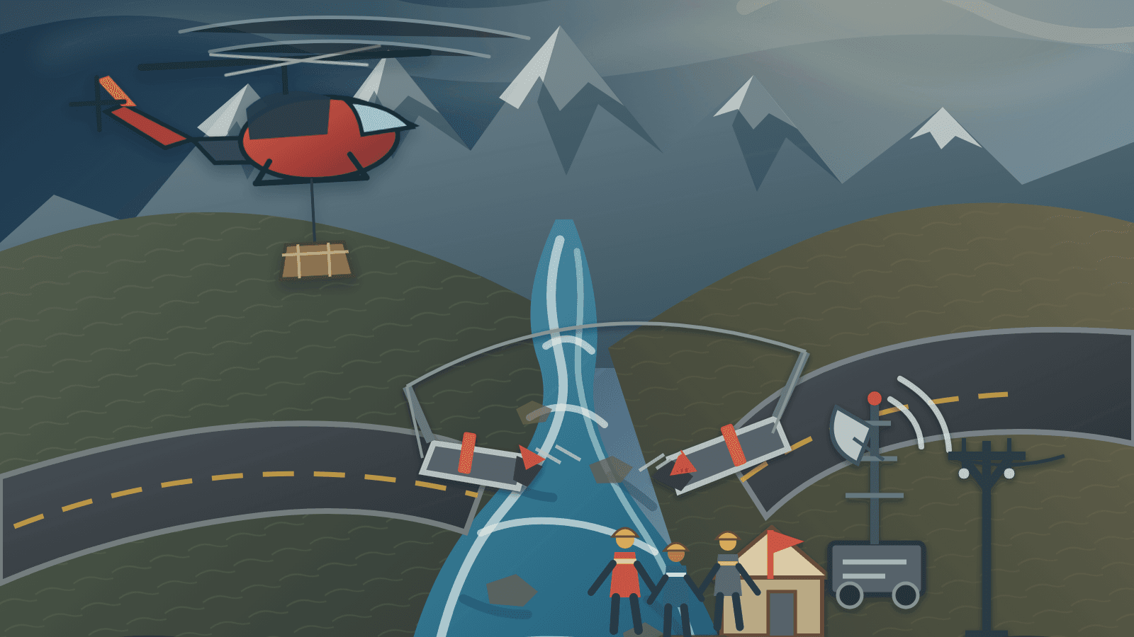
At a glance
- Date and location
- Nepal’s Ministry of Home Affairs places the Bhote Koshi flood in Rasuwa at 8:40 a.m. NPT on August 26, 2026. It identified riverbank areas in Rasuwa, Nuwakot, Dhading, and Gorkha, among other districts, as affected.References:S04
- River corridor
- ICIMOD described a surge of water, sediment, and boulders moving through the Bhote Koshi into the Trishuli system.References:S13
- Official status
- NDRRMA Situation Report No. 6 is the newest numbered report. A later NDRRMA update, with information through 8:30 a.m. NPT on August 28, controls the current figures used below.References:S01S02
- Rescue and relief
- That update listed 3,253 total rescues without dividing them by service or by air and ground method. It recorded 13,295 security personnel across three distinct services and 15 rescue helicopters split between six Nepali Army and nine private aircraft. All are provisional, dated snapshots.References:S01
- Access and infrastructure
- Official records described blocked or damaged road corridors, bridge and utility impacts, heavy-equipment work, and temporary-access planning. A definitive current NH42 status and complete power-restoration timetable were not available in the reviewed official material.References:S02S03S12S17
- Cause assessment
- ICIMOD was examining an ice-rock avalanche and possible temporary blockage involving Lende Khola. The exact trigger had not been finalized.References:S13
What happened in the Bhote Koshi–Trishuli corridor
The first official sequence is unusually precise about activation but less final about the physical trigger. The Ministry of Home Affairs places the flood in the Bhote Koshi at 8:40 a.m. NPT on August 26. The Prime Minister’s office separately records 8:40 as the time local administration reported the event. MoHA named riverbank areas in Rasuwa, Nuwakot, Dhading, and Gorkha among the affected geography, making clear that the list was not necessarily exhaustive.
ICIMOD described water, sediment, and boulders moving from the Bhote Koshi into the Trishuli river system. Farther along the corridor, DHM’s event-day chart for the Trishuli at Kali Khola recorded 12.346 metres at 2:20 p.m. NPT, just above that station’s posted 12.1-metre danger level. That is a dated observation at one gauge—not proof of the river’s condition everywhere, and not a current all-clear. Several relevant gauges also stopped reporting early on August 26, limiting the operational picture.
The corridor mattered because the river and the transport network occupy the same constrained mountain geography. The Department of Roads event feed described damage and closure on NH42 at Khalte, Syafrubesi, and Timure, while NDRRMA reported heavy machinery being used or prepared on affected road sections. Government reports also treated roads, bridges, hydropower, communications, electricity, and drinking-water systems as linked recovery priorities. The DoR feed did not provide a clean, current post-flood status for every segment, so this analysis does not declare the full route reopened or assign a final bridge count.
The cause requires equally careful wording. NDRRMA Report No. 6 attributed the event to a large ice-rock fall north of Lhende Khola and reported a preliminary satellite assessment of an obstruction and temporary lake. ICIMOD’s scientific assessment remained more cautious, examining an ice-rock avalanche and possible temporary debris blockage while saying the exact chain of events was still under investigation. ICIMOD also said no causal link had been established between recorded seismic signals and the flood. The event should therefore not be labeled conclusively as a glacial-lake outburst, glacier collapse, earthquake-driven flood, or failed landslide dam.
Response and recovery timeline
August 26, 8:40 a.m. NPT
Flood reported and recorded
MoHA places the Bhote Koshi flood in Rasuwa at this time; OPMCM records that local administration reported it at 8:40.
August 26, 8:45 a.m. NPT
Civilian direction issued
The Prime Minister directed concerned bodies and organizations, including security agencies, to undertake search, rescue, and relief.
Source:S05
August 26, 9:00 a.m. NPT
Riverbank warnings expanded
District administrations and local authorities kept riverbank areas on high alert and asked residents to remain in safe places and avoid riverbanks.
Source:S05
August 26, 9:15 a.m. NPT
NDRRMA emergency meeting
The National Disaster Risk Reduction and Management Authority held an emergency meeting.
Source:S05
August 26, 9:35 a.m. NPT
Responder alerts sent
NDRRMA arranged alert messages through Nepal Telecom and Ncell for provincial, district, and local responders to mobilize on high alert. The source does not prove delivery to every handset.
Source:S05
August 26, 11:00 a.m. NPT
National disaster council met
The National Disaster Risk Reduction and Management Council met, and the Prime Minister asked all concerned actors to support search, rescue, and relief.
Source:S05
August 26, 12:30 p.m. NPT
Cabinet intensified operations
The Cabinet decided to intensify the operation. Nepali Army and private helicopters were used in Rasuwa and Nuwakot, and joint medical teams were sent to Nuwakot District Hospital.
Source:S05
August 27 (official statement; time not stated)
Army evacuation and medical work reported
The Nepali Army reported helicopter evacuations from Timure, Dhunche, and Mailung, alongside ground search, emergency treatment, relief distribution, and a treatment centre in Trishuli.
Source:S06
Information through August 27, 10:00 p.m. NPT
Situation Report No. 6 status cutoff
NDRRMA described specialized coordination teams, heavy-equipment work, health and relief activity, and continuing residual-risk monitoring. Its conflicting personnel and rescue totals are not used here.
Source:S02
Information through August 28, 8:30 a.m. NPT
Later NDRRMA status cutoff
The update listed 3,253 total rescues, 13,295 deployed security personnel across the three services, and six Nepali Army plus nine private rescue helicopters. It did not split rescues by service or method.
Source:S01
Role of the Nepali Army
The clearest Army evidence comes from the Nepali Army’s own dated statement and from NDRRMA’s joint-response reporting. The Army said its helicopters evacuated people from Timure, Dhunche, and Mailung. It also reported personnel engaged in ground search and rescue, emergency medical treatment, distribution of relief, and an emergency treatment centre in Trishuli staffed by specialist doctors and medical personnel. The Army statement contains no usable personnel total and no Army-only rescue total, so neither is inferred from it.
Sources:S06
NDRRMA’s 8:30 a.m. August 28 snapshot listed 4,200 Nepali Army personnel within a combined deployment of 13,295 security personnel. The same update said six Nepali Army and nine private helicopters—15 total—were assigned to rescue. Those figures describe a dated deployment snapshot. They do not say that 15 Army aircraft operated, that 15 sorties flew, or that every one of the 3,253 reported rescues was performed by the Army or by helicopter.
Sources:S01
Army capability mattered where roads could not provide immediate access. Rotary-wing aircraft can reconnoitre a damaged corridor, move injured people, and deliver small high-priority loads, while ground teams can search, provide medical care, handle relief, and support access work. In this response, however, aviation was explicitly mixed: government records distinguish Army from private aircraft, and the civil-aviation coordination team handled permissions and overall rescue-helicopter coordination with the Army, private operators, MoHA, and district security committees. That is a joint aviation system, not an Army-only air bridge.
The same distinction applies to engineering and logistics. NDRRMA placed the Army inside joint teams concerned with roads, emergency health, search and evacuation, and communications, but those teams also included civilian ministries, technical authorities, police services, and commercial operators. The mobilization plan assigned power-backup work to a separate team that did not include the Army. The available sources establish Army support to a civilian-directed response; they do not establish military command of the overall disaster operation.
Nepal Police, Armed Police Force, and civilian responders
Nepal Police records support a different operational profile. Police deployed additional teams for search and rescue, relief distribution, body management, documentation, damage assessment, communications, and coordination to restore movement on affected roads. Other Police teams were deployed to establish an emergency coordination centre and staff a hospital command post, alongside K9, drone, medical, family-liaison, and district focal-point functions. Those are Police roles; they should not be folded into an undifferentiated “army” response. Dated Police team counts and its rapidly changing human-impact totals are omitted.
Armed Police Force Nepal described deployments with rescue equipment in Rasuwa, Nuwakot, Dhading, and Chitwan. Its official update records movement of pre-positioned Disaster Relief System containers, a medical-and-rescue team with a Mass Casualty Vehicle, siren and loudspeaker warnings in at-risk settlements, hospital readiness, and landing zones for both Nepali Army and private helicopters. It also described K9 and drone work, emergency water purification, medicine distribution in displacement camps, and information exchange with Chinese counterpart agencies about possible further upstream risk. The source supplies no APF personnel, rescue, aircraft, supply, or beneficiary count.
Sources:S09
Civilian and humanitarian responders filled other gaps. OPMCM described medical teams drawn from the three security services and civilian hospitals, while WHO reported dispatching emergency medicines, medical supplies, and multipurpose tents and supporting surveillance and continuity of essential health services. UNICEF and IFRC described work across water and sanitation, shelter, health, psychosocial support, family links, child protection, and relief distribution. These sources establish participation in their own fields, not control of Nepal’s national response.
Civil-military coordination
Nepal’s official activation record is civilian-led. The Prime Minister issued the early direction; district administrations and local authorities handled riverbank warnings; NDRRMA convened an emergency meeting; the national disaster council met; and the Cabinet decided to intensify operations. MoHA, NDRRMA, district emergency operations, local government, health services, technical ministries, and security organizations then worked through joint arrangements.
The mobilization plan shows why the phrase “military-led” would be inaccurate. A communications-restoration team brought together the communications ministry, Armed Police Force Nepal, the telecommunications authority, Nepal Telecom, Ncell, the Nepali Army, Nepal Police, and MoHA. A civilian-led roads team combined infrastructure authorities, DoR, the Army, Road Board, transport operators, Police, and MoHA. A National Planning Commission official led rapid damage and needs assessment. The Civil Aviation Authority of Nepal led overall coordination for rescue-helicopter mobilization.
Sources:S03
MoFA’s Emergency Control Room had a narrower but important role: verifying information and assisting foreign nationals affected by the flood. Its notice describes a central coordinating mechanism within the ministry, not the national incident command. That boundary matters in a border and tourism corridor, where consular casework, identity verification, family contact, aviation, and local rescue information must connect without confusing responsibility.
Sources:S10
Military capabilities can add aircraft, trained search teams, medical support, logistics, communications, and engineering capacity quickly. Civilian disaster governance still has to set priorities, reconcile information, allocate access, manage public warnings, coordinate health and technical agencies, and decide how immediate response becomes recovery. The official record supports that complementary relationship: distinct security-force capabilities operating inside civilian executive and interagency coordination.
Mountain rescue and logistics constraints
Mountain rescue is a problem of reach as much as resources. Steep terrain narrows road options, and flood or debris damage can sever the same corridor needed by ambulances, excavators, line crews, fuel, food, water, tents, generators, and communications equipment. When a bridge or road segment fails, the consequence is not only a transport delay; it can slow assessment, casualty movement, utility repair, and relief distribution at the same time. Official road and humanitarian reports described isolated communities, damaged access, and limited phone signals.
Helicopters reduce some access constraints but introduce others. Weather, visibility, valley winds, landing-zone safety, load limits, fuel, maintenance, flight permissions, and the need to prioritize patients or supplies all shape what aircraft can do. APF’s preparation of landing zones and the CAAN-led aviation team illustrate the ground-and-air coordination required before a helicopter becomes useful to an isolated community.
Communications gaps complicate every decision. A responder cannot prioritize a village, dispatch a medical team, or reassure a family without reliable location and status information. NDRRMA’s specialist arrangements joined public agencies, telecom operators, and the three security services; humanitarian reporting also described limited signals. Redundant radio, satellite, mobile, and in-person reporting may therefore be necessary while commercial networks and grid power are impaired. The first sentence is sourced operational context; the redundancy point is DomyClass emergency-management analysis.
Foreign visitors and border-area movements add a further information burden. MoFA’s control room supported consular verification, while APF reported cross-border risk-information exchange. These activities do not substitute for rescue command, but they help connect missing-person data, family enquiries, identity checks, travel movements, and upstream warnings across institutions and jurisdictions.
Cascading infrastructure and enterprise risk
This is DomyClass emergency-management and enterprise-risk analysis based on official reports, not an official government causal finding.
| Starting disruption | Connected systems | Operational consequence |
|---|---|---|
| Flood and debris damage to roads or bridges | Ambulances, search teams, excavators, utility crews, fuel, food, water, and shelter supplies depend on the same constrained routes. | Slower access can delay rescue, assessment, repair, and relief simultaneously.References:S02S12S15S16 |
| Hydropower, grid, or backup-power disruption | Telecommunications, health facilities, water systems, lighting, refrigeration, and emergency coordination depend on electricity or finite backup supplies. | Reduced visibility and service continuity increase reliance on generators, fuel logistics, and mobile systems.References:S03S15S16S17 |
| Telecommunications damage or weak signal | Warning, dispatch, missing-person reporting, consular work, family contact, and repair coordination all rely on usable channels. | Incomplete information can produce duplicated effort, missed locations, or poor prioritization.References:S03S15S16 |
| Border and tourism disruption | Foreign-national verification, transport, local supply chains, accommodation, and business continuity intersect. | Response agencies and operators must manage rescue needs while maintaining identity, movement, and continuity information.References:S09S10S15 |
| Uncertain upstream hazard | Riverbank warnings, landing plans, road work, camps, and responder safety can all change with renewed flow or landslide risk. | Plans require triggers, fallback locations, and frequent reassessment rather than one fixed schedule.References:S02S13 |
The enterprise-risk lesson is interdependence. A road is both an asset and a control that enables other controls; a communications network is both a service and the information layer for every response decision. The ITS 835 perspective is useful here because risk identification, operational continuity, response prioritization, supply-chain disruption, and recovery planning must be handled as a connected portfolio rather than separate technical lists. This is an educational relationship only; ITS 835, the University of the Cumberlands, and DomyClass did not participate in Nepal’s response.
Recovery and mitigation priorities
The official reports suggest several emergency-management lessons. These priorities are DomyClass analysis; the reviewed sources do not establish that every measure has been formally adopted.
Connect survivor support to rehabilitation
Immediate shelter and survivor support need a bridge into rehabilitation: safe temporary sites, health services, water and sanitation, psychosocial care, family links, and culturally appropriate relief should be planned alongside longer-term housing and livelihood decisions. WHO, UNICEF, IFRC, and Nepal Red Cross material supports the breadth of these needs, while MoHA emphasized both immediate safe accommodation and longer-term rehabilitation.
Restore access by service priority
Temporary crossings and debris clearance should consider not only traffic volume but also which route unlocks isolated settlements, hospitals, telecom sites, power repairs, water systems, and supply distribution. The NDRRMA road team’s assignments included Bailey-bridge arrangements, reopening blocked roads, regular transport coordination, and traffic management. The available record does not show that each task had been completed.
References:S03
Design power and communications together
Backup generation requires fuel, maintenance, safe siting, transfer equipment, and an order of priority for clinics, emergency operations, water systems, shelters, and telecom nodes. Communications resilience likewise requires tested radio, satellite, mobile, and community-based alternatives rather than a paper list of devices. These are DomyClass planning lessons grounded in the official coordination structure and reported utility and signal disruption.
Turn hazard uncertainty into decision triggers
Preliminary satellite and field assessments can guide caution without being treated as final cause findings. Plans should specify who validates a warning, who contacts riverbank communities, what thresholds trigger evacuation or road closure, and how to reach people when networks fail. ICIMOD’s continuing cause assessment and NDRRMA’s dated residual-risk warning illustrate why uncertainty itself has to be operationalized.
Pre-position aviation, relief, and border plans
Relief containers, water-treatment capacity, medical supplies, landing-zone surveys, compatible communications, fuel arrangements, passenger and cargo priorities, and flight-permission procedures are more useful when agreed before roads fail. Tourism and border-route plans should connect local authorities, security services, hospitals, transport operators, consular officials, and accommodation providers so that visitor information does not become a separate, delayed workflow.
What remains uncertain
- The final physical trigger and the sequence among ice-rock fall, debris, obstruction, temporary impoundment, and release remain under assessment.References:S02S13
- Final casualty, missing-person, injury, rescue, and displacement totals remain provisional. This article retains only the dated combined rescue snapshot and omits casualty, missing-person, injury, and displacement totals.References:S01S02
- Complete road, bridge, hydropower, telecommunications, drinking-water, housing, and public-facility damage totals were not final in the reviewed record.References:S02S04S15
- The current status of every inaccessible location and each NH42 segment was not resolved by the official road feeds reviewed for this lock.References:S12
- Event-specific NEA outage, generation, hydropower-impact, and restoration timelines were not available in the reviewed official material.References:S03S17
- Long-term housing, rehabilitation, livelihood, and psychosocial-support requirements will depend on continuing assessment.References:S04S15S16
- Secondary flood, natural-dam failure, and landslide risks remained subjects of dated warning and preliminary assessment, not confirmed future outcomes.References:S02S13
- The complete international-assistance requirement remained unsettled; verified humanitarian organizations were active, but their own estimates and appeals are not a substitute for a current government total.References:S10S14S15S16
Related DomyClass resources
For students examining disaster response and risk management, the following DomyClass resources connect the event to relevant planning, mitigation, recovery, and enterprise-risk concepts.
Sources and updates
DomyClass compiled this analysis from official public reports, operational updates, and humanitarian sources. Figures may change as search, rescue, assessment, and recovery work continue.
Latest official status reviewed: August 28, 2026, 11:34 a.m. NPT
- S01Bhote Koshi flood search, rescue and relief update (through 8:30 a.m. NPT)National Disaster Risk Reduction and Management AuthorityPublished August 28, 2026Reviewed August 28, 2026
- S02Rasuwa Bhote Koshi Flood Search and Rescue Situation Report No. 6 (information through 10:00 p.m. NPT)National Disaster Risk Reduction and Management AuthorityPublished August 27, 2026Reviewed August 28, 2026
- S03Rasuwa flood-response mobilization teamsNational Disaster Risk Reduction and Management AuthorityPublished August 27, 2026Updated August 28, 2026Reviewed August 28, 2026
- S04Heartfelt appeal concerning the Bhote Koshi floodMinistry of Home Affairs, Government of NepalPublished August 27, 2026Reviewed August 28, 2026
- S05Bhote Koshi flood response press releaseOffice of the Prime Minister and Council of Ministers, Government of NepalPublished August 26, 2026Reviewed August 28, 2026
- S06Search, Rescue and Relief Distribution by NANepali ArmyPublished August 27, 2026Reviewed August 28, 2026
- S07Additional Nepal Police teams deployed for flood search and coordinationNepal PolicePublished August 27, 2026Reviewed August 28, 2026
- S08Nepal Police specialist-team deployment for the Rasuwa floodNepal PolicePublished August 26, 2026Reviewed August 28, 2026
- S09Armed Police Force Nepal response to the Rasuwa floodArmed Police Force NepalPublished August 26, 2026Reviewed August 28, 2026
- S10Emergency Control Room for foreign nationals affected by the Bhote Koshi floodMinistry of Foreign Affairs, Government of NepalPublished August 27, 2026Reviewed August 28, 2026
- S11Real-time streamflow data and Trishuli River event-day chartDepartment of Hydrology and Meteorology, Government of NepalPublished August 26–28, 2026Updated Live station data reviewed August 28, 2026Reviewed August 28, 2026
- S12National highway closure and road-status dataDepartment of Roads, Government of NepalPublished August 26–28, 2026Updated Reviewed August 28, 2026Reviewed August 28, 2026
- S13Major flash flood sweeps through Nepal’s Rasuwa districtInternational Centre for Integrated Mountain DevelopmentPublished August 26, 2026Updated August 27, 2026Reviewed August 28, 2026
- S14WHO Nepal statement on the Rasuwa floodsWorld Health Organization NepalPublished August 26, 2026Reviewed August 28, 2026
- S15Flash floods in Nepal: humanitarian needs and responseUNICEFPublished August 27, 2026Reviewed August 28, 2026
- S16Emergency appeal for the Nepal flash-flood responseInternational Federation of Red Cross and Red Crescent SocietiesPublished August 27, 2026Reviewed August 28, 2026
- S17Nepal Electricity Authority official information portalNepal Electricity AuthorityUpdated Site reviewed August 28, 2026Reviewed August 28, 2026
Official reports and assessments may be corrected or expanded as access and verification improve. Contact DomyClass to suggest a correction.
Get Help With EDMG503 Emergency and Disaster Planning and Management at American Military University
Get targeted EDMG503 help and improve your grades.
Get EDMG503 Help